Класс Месторождения: Крупное
Тип Месторождения: Нефтегазовое
Местоположение:
Местность:
Стадия разработки: Доразведка
Год открытия: 2003
Источник информации:
Метод открытия:
Площадь: 24.58 км²
Baleia Azul Field
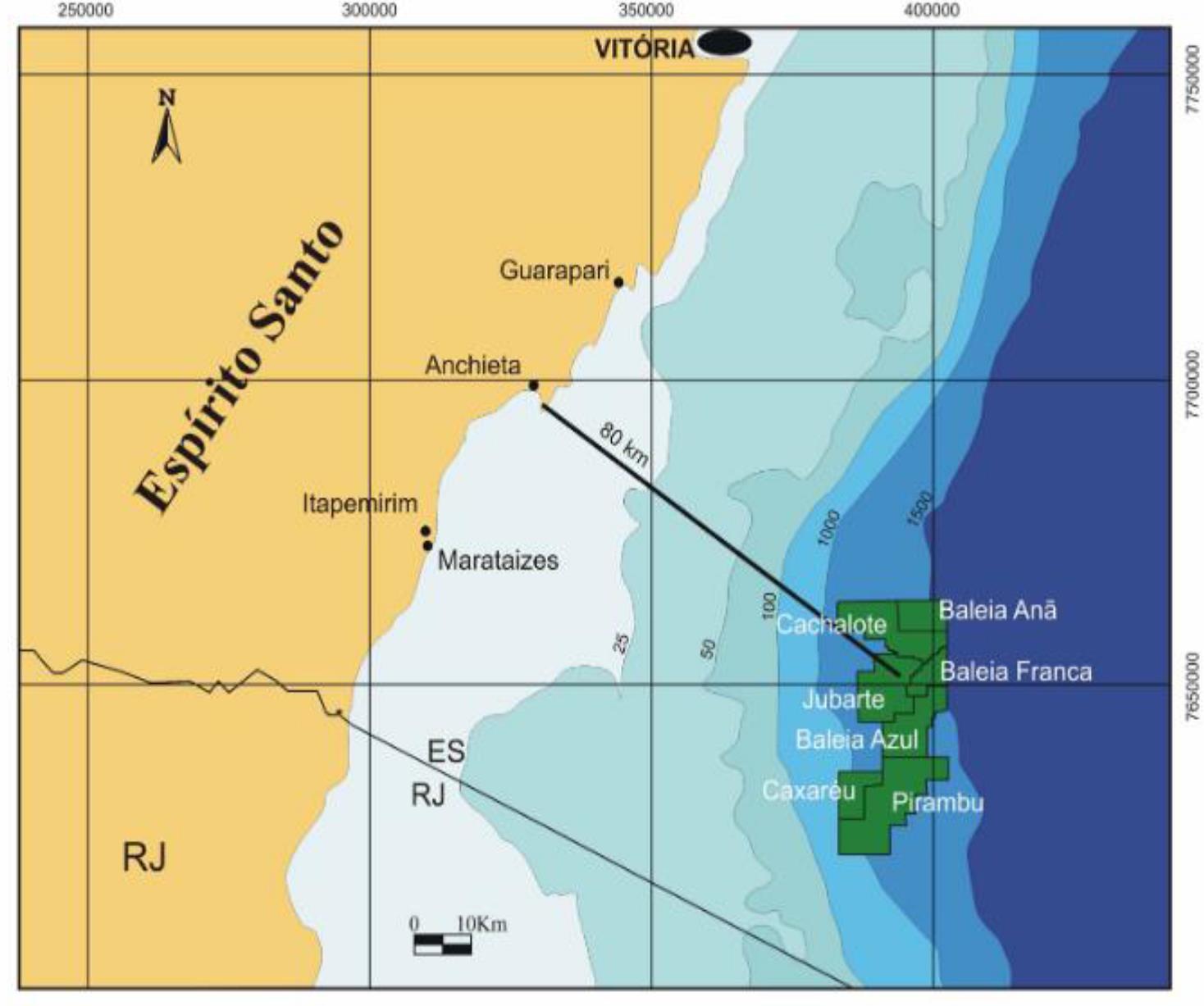
The Campos Basin is a passive margin basin formed from a rift, and is located between the Vitória High, to the north, and the Cabo Frio High, to the south, with an area of approximately 100,000 km² (Pereira, 2015). The Baleia Azul Field (Fig. 1) is located approximately 80km from the coast of Espírito Santo state with an area of 63.69km², where the water depth varies from ca. 1200m in the proximal area to ca. 1500m in the distal area.
Figure 2: Location map of the Parque das Baleias cluster, Campos Basin, SE Brazil. Modified from ANP/BDEP WebMaps (2019).
Geological settings
The thermal evolution of the Campos Basin occurred in two main stages of subsidence. The initial stage occurred between 130-68M with a rift followed by a thermal subsidence with a sedimentation rate of 30m/Ma, high crust stretching factor and high heat flow variation (Cardoso, 2007). The duration of the rift opening was 10Ma. The final stage occurred between 68-0Ma with a sedimentation rate of 19m/Ma, a lower crust stretching factor and a drastic drop in the sediment heat flow.
The sedimentary deposition in the Campos Basin occurred in 3 main phases (Pereira et al, 2015). The first phase, starting 130Ma ago, was the rift phase with predominantly continental sedimentation over the crystalline basement, composed of medium to high grade metamorphic rocks. The second phase was the transitional phase or sag phase, where the evaporites from the basin were deposited. The third phase was the drift phase, with 3 distinct depositional regimes: carbonate platforms, transgressive marine and regressive marine sedimentation.
The main Pre-salt source rocks in the Campos Basin are the Buracica-Jiquiá shales of the Barremian-Aptian of the Lagoa Feia Group deposited in the rift phase, in a lacustrine environment. The oil generation window in the Buracica-Jiquiá time is estimated between 30Ma and 2Ma, where the depth at the end of the generation window reaches 6500m. Such shales have TOC content of 2-6%, kerogen type I and produce oil ranging from 17-37º API. It is not ruled out the possibility of source rocks among the marine sediments of the post salt (Pereira et al, 2015).
The main reservoirs of the Baleia Azul Field are the microbial carbonates of the Macabu Formation (Aptian) and turbidite sandstones of the Carapebus Formation (Santonian-Miocene) with maximum porosity levels varying from 20-32% and permeability between 1D -5D (Pereira et al, 2015).
The seal rocks are shales of the Coqueiros Formation (Aptian), evaporites of the Retiro Formation (Aptian), mudstones and shales of the Outeiro Formation (AlbianCenomanian), and shales of the Ubatuba Formation (Turonian-recent). The inferred migration pathways are salt windows (where there are no evaporites from the Retiro Formation) or direct or lateral contacts due to faults (Pereira, 2015). Throughout the evolution of the basin, structural, stratigraphic and mixed traps have been identified: quaquaversal structures, rotated failed blocks, rollover faults, sandy canalized reservoirs (Pereira et al, 2015).
Data source:Reconstitution of the depositional history of the Baleia Azul Field, Campos Basin: The first step for a 1D petroleum system modelling. Maria Luiza Cyrino Paiva, Mathieu Ducros , Matheus Lima Lemos de Oliveira; Anderson Rafael Rezende Alves; Antonio Fernando Menezes Freire; Wagner Moreira Lupinacci, 2019
Следующее Месторождение: Catua